Showing posts with label Dirty 130. Show all posts

Wednesday, July 19, 2023

Dirty 130


Always love the pre dawn starts

Hi.  I am Carey and I am a bikealholic.

I have done this race/ITT 5 times now.  I could probably just cut and paste from my previous reports. Even though the DMR YoYo was just 2 weeks ago, I decided to give it a go, as I had the opportunity in the calender to do so. I also had a camping trip with my family that started in 2 days, so I wanted to get all my "zoomies" out of me in order to not have any bike FOMO while vacationing. I invited John Switow to join in my madness, as he is a sucker for BDR's. 


Must document start and finish


This is the first time I chose to ride my Niner Air9 RDO.  The combination of age and route deterioration had me wanting bigger tires and front suspension.  The time I figured I would lose on the road sections would well be made back by the comfort over the long haul and on the fast chunky descents. I rode Maxxis Ramblers 50mm.  I chose 2 28 ounce water bottles and was able to put all my nutrition and tools on my bike (Revelate Designs feedbag and Oveja Negro top tube bag).


Even though we started at the same time, I made sure to follow the rules set forth by Kim Murrell and TennesseeGravel.com. The only thing we shared was conversation. 

It was a muggy 68 degrees at the start (dew point of 70).  Highs were expected in the upper 80's, with only a slight chance of showers (which I was hoping for).  As we began the 10 mile climb up Kimsey Mountain Hwy (FS 68), the legs felt surprisingly good, not sparkly, but way better than I had expected.  However, what I wasn't expecting was lower back pain halfway up the climb. I already knew this might be a problem, as I had woken up to my usual stiff lower back.  Normally,  I try to avoid NSAID/s the day of a big ride/race, but I took 2 Aleve.

Occasionally I would stand and pedal, which alleviated the pain.  I was hoping that my back would sort itself out over the next hour, because there was no way I could handle this amount of discomfort all day. The sunrise was spectacular as I crested the climb.  The beauty of these mountains surrounded me in comfort and awe and I descended Smith (FS 80) with gratitude, for my ability to play these games.  Smith had gotten some "love" earlier this year, but Mother Nature was determined to take it back to its chunkified state.  It was nice to descend this rowdy section on my Niner.

On the way over to Lost Creek, my back kept getting angrier.  Part of me was beginning to have thoughts of pulling the plug once I hit Hwy 30, but the mental game was strong and the other part of me just said to give it some more time.  Since the legs were feeling well, I stood and pedaled quite a bit on this section over to Webb Store.

Stopping at Webb's, I pee'd, refilled my bottles, and then stretched for 5 minutes while I waited on John to do his thing.  That helped some and then we were off to Hambright Road. Once the pavement turned to two-track, then to single track, I weaved my way around the mud and downed trees.


Making use of my fine bushwhacking skills

While I have heard through the grapevine that some riders opt to walk along the railroad tracks on the gravel, go through the creek, and then continue on the railroad gravel, that is NOT the official route.  FYI, the official route is on the mud-hole filled, over grown road bed, which lies 10-50 feet from the railroad.  If you want an official ITT time, you must take the more difficult path.


The crossing was almost chamois-deep for me.

Climbing up Starr Mountain, I began to feel the warmth of the day, like a hot heavy blanket draped over me. My back pain came back with a vengeance, and once again those thoughts of quitting entered my mind.  "I could finish this gravel section and pedal on nice flat pavement back to my truck.  I don't have to prove anything to anyone.  Haven't I done this route enough?"  While these thoughts kept playing on repeat, that gritty and gristled side of me wanted to prove to my weaker side that I could endure and persevere.  I told myself, just get to Coker Creek, enjoy a Coke, and stretch some more.  The pain will eventually leave if it realizes it is not going to win out.

I was able to rally on the ridgeline and felt good on the gravel descent down to the pavement.  I slowly pulled away from John on Ivy Trail; I think the heat was beginning to get to him.  Those 10 or so miles on pavement felt so slow, probably because of the mountain bike I chose and the fact that I was thinking I should be able to go at road bike speeds.

I made it to the Coker Creek visitor center and ate a rice cake ✔, pee ✔, apply Chamois Butt'r ✔, soak head/face in sink ✔, drink Coke ✔, refill bottles ✔, stretch back ✔. I multi-tasked to be more efficient, but it was kind of hard to eat my rice cake when I was bent over touching my toes 😆.  John arrived while I was almost finished and told me to go on, as he was in the middle of dealing with his own pains, cramping specifically.

That 13 minute stop was what I needed and miraculously I had no more lower back pain for the remainder of the ride. The miles over to Buck Bald were quite pleasant, as the gravel/dirt was hard packed. It was a slow go up to Buck Bald, as the heat was sweltering by now. But knowing that this was a day for adventure and not for PR's, I was in the right mindset, and I embraced the warmth.


Toasty!

The 17 miles back to Reliance was tough, not gonna lie.  The heat was getting oppressive and I did not want to blow a head gasket, so this was one of my slowest sections. I stopped along the Hiwassee and cooled off in Towee Creek for about 10 minutes. 
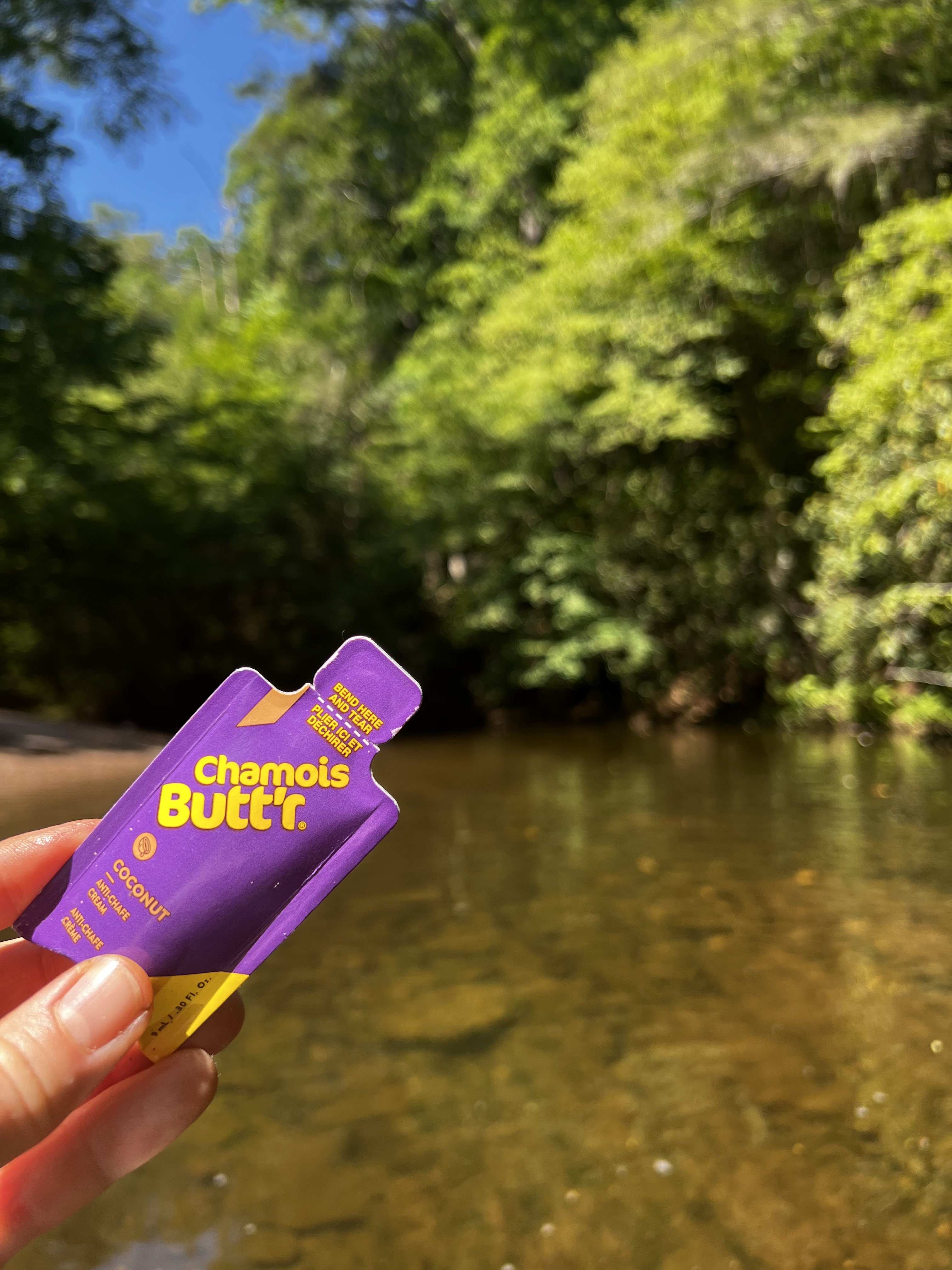

Keeping the bits happy after cooling off the engine.

I cooled off once again at the piped spring (mile 107) by sticking my head under the pipe.  Man, that felt so good and refreshing! By now early evening was upon me, leaving me with the final climb, but a doozie at 11 miles, with the last 4 being spicy!  It was still warm, but the sun's rays were no longer searing hot.  As I turned onto the double track of death climb, it was hard not to love life and hate it at the same time.  This is a beautiful stretch of road, but rugged as hell. I was elated to have persevered through the pain earlier in the day, where I had thought of quitting 13 times, but now it was replaced by extreme fatigue.  I was trying to remember how many steps there was to this climb: 3? 4?  Try 5!  Every time I thought that this was the last, I would round the corner and the road went back up. Finally I hit the short little descent that would drop me out on Kimsey Mountain Hwy (FS 68).  And I felt like a pinball , pinging off the gazillion baby heads.

This section of Kimsey, that climbs for 2 miles back up to the intersection of Smith Mountain was no better.  Because it was essentially a Paris Roubaix-like cobbled climb.  All the dirt had eroded, leaving a conglomeration of wicked, lumpy rocks. I couldn't hold it in any longer and my sailor mouth erupted in expletives.  That actually made me feel better and I bounced my way back up to the intersection.  From there, the road smoothed out and I knocked out that last little bit of climbing with renewed energy; guess I was smelling the barn.

The descent was SO MUCH MORE pleasant on my mountain bike.  My teeth didn't feel like they were gonna rattle out, and my eyeballs weren't bouncing around in my skull.  I was able to sit on the saddle quite a bit, which then allowed me to hit those few little kickers towards the end with gusto.

I finished with a time of 13:35 (moving time of 13:01). It never is easy (well, maybe the 2018 version), but I swear it keeps getting harder as I get older, although today's difficulty was probably a combination of the heat and only being 2 weeks recovered from the DMR YoYo. But deep down inside, I love these challenges.


I rested awhile on the concrete; it felt so good to just be still.  I waited on John, figuring he would probably be about an hour behind me.  But when dark thirty approached, I started to get nervous, thinking the worst.  I should have gotten the link to his Inreach, but later he told me it had died several hours ago, so it wouldn't have helped anyways.  Finally around 9:45pm, I saw bike lights off in the distance.  Whew!  John pulled in, looking like a corpse.  He had a helluva second half, working through cramps and ended up walking more than he wanted.  But he stuck it out and finished this beast.

Saturday, April 24, 2021

Dirty 130 ITT Race Report


This route, designed by Kim Murrell, is one of three races hosted by Tennessee Gravel.  This year it is happening as an ITT event, which I kind of like, because I got to choose my date, ensuring that at least I would not be out in the rain.  But not wanting to do it alone, I invited my Rescue Racing team mate, David Jolin, from Ohio.  A race of this magnitude would be much more endurable with a friend to share the highs and the lows.


We managed to start a little before 6 am.  The temperature was 40 degrees, but we warmed up quickly as the first 10 miles was all climbing. Knowing this route, I had not turned on my navigation, in order to conserve battery life.  We went by where the Great Pyrenees lives.  He barked but did not give chase.  My one and only navigational error came at mile 2.5, where I proceeded straight up the hill (Chestnut Mountain Road), as opposed to going slightly left onto what would turn into FS68.  My intuition immediately kicked in, but I stupidly chose to disregard it.  I turned on my navigation then, but it was confused and so I wasn't getting the "off course" message.  A half mile later, I finally realized the error, we turned around, and got back on track.


The sun began to rise as we approached the top of the climb.  As we headed on to FS 80, I stuffed a banana into my mouth.  No enjoying eating here because of the harshness of the terrain and it soon began going downhill.  This 6 miles of mostly descending was super chunky what with the embedded rock and several wash outs.  I descended cautiously, as I did not want to flat.  What warmth I had obtained in the previous climb completely left me about halfway down. Because I have Reynaud's, my fingers and toes became painfully cold. With extremities that felt like cinder blocks and eyes watering so badly I could hardly see the road, it was a miracle I stayed upright.  When I turned right onto FS 23, the descending and the misery continued. All I could do was endure, knowing that I would eventually warm up.  I was frustrated as I knew I could go faster, if I just wasn't so friggin' cold.  Garmin was registering 36 degrees.

Left onto FS 103, and my body slowly began to warm up. Climbing never felt soooo gooood!  The re-freeze began on the next descent down to Lost Creek.  Climbing out of Lost Creek, my little reptilian body began to feel the warmth of the sun, and I was almost done with this freeze/thaw situation. Hitting Hwy 30, I was finally 100% warm again and relishing life once more. Although I could have done without the 60 minutes of being miserable, it's this hard shit that makes me feel alive and so appreciative of the "easy" parts.


We stopped at Webb's Store for a pee break and bottle refill.  It was here that I enjoyed one of my rice cakes. Although the air was still cool, the sun's rays beemed down into my soul.  Pedaling on Hambright towards the creek crossing, a very aggressive pit bull mix shot out of the yard right where the road ended and the ATV double track began.  Fortunately I had just enough momentum to get around him before he latched onto a body part and just enough "runway" left before I had to brake hard to avoid the overgrown trail.  


We stopped at the creek to take our socks/shoes off and wade across.  Although there was a perfectly good railroad trestle over the river, it was off limits. This ate up a good chunk of time as we had to dry our feet and brush all the sand off.  But well worth it, as my feet would have been popsicles had I waded through with shoes on. At this point in the day (9:30 am) it was still in the mid-40's.

Knee deep for me, mid calf for David


Praying my foot would not find a fish hook or broken beer bottle.

After negotiating the multiple mud holes after the crossing, we hit the flat gravel section back to Hwy 315.  I had managed to get my shoes a little muddy in the process, but the annoying Sponge Bob sound I had been hearing like a metronome with each pedal stroke for the past 35 miles mercifully went away.  About the only time that I have been happy I sunk my shoe in mud.


FS 44

The Starr Mountain gravel was in primo shape.  It felt that we were through that section and sailing down the pavement to Hwy 315 in no time.  The sun was shining, the last of the bone-chilling cold left me, and my pistons were firing quite well.  The next 10 miles, on pavement, included Ivy Trail, Towee Falls, Epperson, and Hotwater.  It took almost just as long to ride those paved miles as it did the Starr Mountain gravel.  Some of the steepest grades of the day are on Ivy. The same dog gave chase on Towee as it did back in 2018.  But this time it's owner was not firing up its shock collar. Fortunately its aggression had mellowed, and deemed us not worthy of any extra calorie expenditure.


Enhanced rollers between Hwy 315 and Hwy 68


Although the Coker Creek visitor center was closed, we still stopped to take a pee break and eat another rice cake.  Looking at the elapsed time, I knew that today was going to be more than 12 hours, which what David had said in the previous week he was shootin' for.  I thought that his time was ambitious, and secretly I hoped it would be 12 1/2 hours of total time.


I was hoping to meet Zeke along the flats of Shuler Road, but we ended up seeing him on the descent off of Unicoi Gap.  We stopped briefly and I introduced the OG's to each other. The conversation was interrupted by a truck coming down the gravel.  Not wanting to get caught behind it on the descent, I told the guys that we needed to mosey along.  Zeke was doing hill repeats so he continued on up to the gap, while David and I cruised down to the flats of Shuler Creek.

We stopped at one point to filter water and I ate my last rice cake.  The remaining 7 miles before the Buck Bald climb, I tried to take it easy and spin a higher cadence because I knew one of the toughest climbs was about to begin.  Being 78 miles in, although the spirits were bright, I was feeling the fatigue start to set in.  1000 feet of mostly rugged double track in 5 miles; I set my mind to thinking about enjoying that PayDay up top and showing David the stunning view.  Half way up we were passed by 6 dual sport riders.  I thought to myself:  betcha we were covering more distance than they today! It was karma that at the top we videobombed the dual sport riders beginning their descent off the bald.


Buck Bald reward!

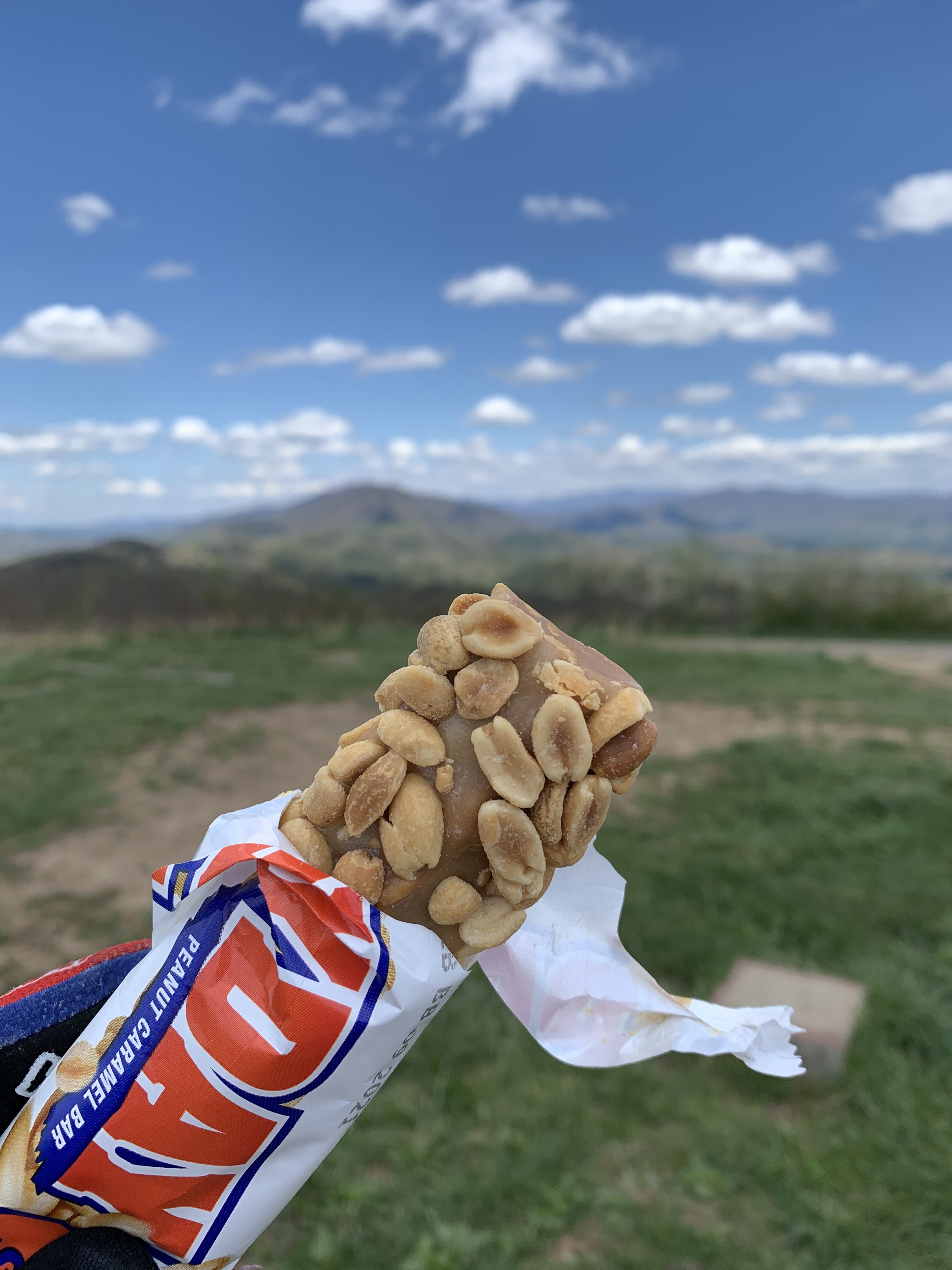
How many people get to enjoy a one of the best ride candy bars on one of the most beautiful balds in the Southeast?  We took several minutes to soak up the view and just appreciate life.


Caption this 😆😆😆


This guy:  so fortunate to have met him at the 2017 Marji Gesick.

The road back down to Hwy 68 had deteriorated since 2018.  The forest service must have put fertilizer down because the embedded rocks had grown tremendously.  Even though I wasn't going all that fast, I still managed to bang my rear wheel on one, which gave me a moment of concern.  Fortunately the tire held. A brief respite on Hwy 68 and then the cursed dog alley on Bailey.  As the big dog gave chase, the owner called out, "He is just wanting to play!"  Seriously?!?  

As the pitch steepened to 14%, I knew I was about to enter the "world of hurt." Why does time always seem to come to a crawl when the pain intensifies.  Over the next two hours, from Bailey Road to the top of the FS 236 climb (20 miles), I was a hurtin' buckaroo.  There are always lows in these races, but I do believe this was one of the longest ones.  I did have a brief respite when I crossed paths with Eddie O'Dea and Audrey Tanguye on Powerhouse, who were out for a 3 day bikepacking trip.  I stopped momentarily and talked with them.  Seeing their fully loaded bikes, I scolded myself for being a wuss.  Seeing them was exactly what I needed to regain my focus. I pulled out a caffeinated Clif double expresso gel, took a hearty dose of liquids, and kept a slow, but smooth pedal stroke up the FS 236 climb.

Eddie and Audrey

That climb was brutal, but I just kept telling myself that there was only one climb left.  Not to mention how loose the gravel was so that I could not even stand without the rear wheel spinning out.  For a large portion of the course, I do believe the graders had come in over the winter and just scraped up all the shit in the ditches.  At first when my energy levels were high, it was just bothersome.  But not as my fatigue grew, it was becoming evil! 

Even though there were 25 miles left, I told myself just 15, as the last 10 were all downhill.  I was trying to stay positive, even though the most heinous of climbs loomed ahead. Cresting 236 I inwardly screamed for joy.  Two tasks left:  find the piped spring and finish off the last climb.  The piped spring came at mile 108.  So ... dang ... refreshing!


No need to filter.

David had been a beast all day.  He would stand and hammer quite a bit on the climbs and never once had anything bad to say.  The perfect partner.  For the most part we stayed in our own little bubble, he always slightly ahead, but never out of sight. He paced off of me, never straying too far or going too hard.  

This last climb, I finally got my shit together, and felt strong again.  Perhaps it was the caffeine shot, perhaps I was smelling the barn, but I hit this 10 mile climb with renewed vigor.  Retired Navy Seal David Goggins, who always says you have more in you to give than you realize, popped into my mind and kicked the monkey out.

    "When your mind is telling you that you're done, that you're exhausted, that you cannot possible go any further, you're only actually 40% done."

I crushed that mountain (second fastest time out of the 4 times I have done this race). Once I hit the rough embedded double track section (McFarland Road) with grades approaching 18% at times, I shouted out expletives, not in anger, but to empower myself, willing myself to fly.  For once I took the lead, trying to pace David up that climb, as he now entered his own pain cave. That was exhilarating!  Once off that embedded rocky road, we had about another mile of smoother gravel before the final descent.  Although the sun was still up, we were now on the shady side, and I could feel the coolness in the air.  I was hopeful I could make it to the finish with plenty of daylight and warmth in my body.

I believe I used up most of that "60 %" I had left at the beginning of the climb.  Because ... that ... 10 ... miles ... of ... descending ... was ... the ... most ... miserable ... I ... have ... ever ... felt ... on ... the ... bike.
The rough road had my body vibrating so hard that I thought my eyeballs and teeth would yard sale.  And then I got cold.  And then I got nauseous.  And when I got light-headed, I had to stop and rest a couple of minutes.  During this period, I could feel my body "hum" with vibrations like a tuning fork.  Back on the bike to endure a few more miles of torture.  Stop again before I pass out.  God, just get me to the pavement!  David had gotten ahead of me on the descent but every so often, he would stop and wait for me. 💓

I was so happy to hit the couple of short climbs during this trek down off the mountain.  My head would clear and my legs worked out of the saddle, feeling like I was starting fresh again.  Finally the pavement and I could relax a bit.  The Great Pyrenees gave chase when David went through; I was about 30 yards behind.  The dog saw me and came within inches of taking me down as he charged towards me.  Whew!  I was thankful for that little bit of good luck, as that woulda no doubt caused some carnage to my body and bike.

We pulled up to my truck after 13 hours and 20 minutes (12:20 ride time).  I could barely throw a leg over my bike to get off.  We both sat on the tailgate and just watched our bodies shake in shear exhaustion/cold.  Damn!  What a day!  I don't know about David, but within 5 minutes, I was thinking of how I could improve on that time when I do it again 😂.  Despite feeling absolutely shelled not 30 minutes prior! Crack head!


Thank you, David, for one helluva day!  At least this time, I did not pass out post ride.  I am looking forward to our next adventure.  Thank you Kim for one beast of a ride and tennesseegravel.com for creating the platform of healthy competition.  Now, where's that pizza!


Friday, June 30, 2017

Dirty 130 ITT Report

After working for 3 days, getting up at 4 am on Thursday, and having an unfavorable HRV score, I was going to be in for a long full day of suffering.  But to us crazy bike addicts, we need this fix, and I am no different.   I love pushing my body and my mind.  I love discovering that I can exceed my perceived limits.

This route takes place in my "backyard."  I have ridden about 70% of this course, but in bits and pieces.  To do this all in one day, self-supported, required a bit of planning.  I used the same set up as for the Dirty Kanza 200, to which I added water purification tabs and some $$.


Bike:  Niner RDO RLT
Wheels:  Industry 9 Ultralite CX (23.5 mm internalwidth)
Tires: Maxxis Rambler 60tpi 40 mm front, 38 mm rear
Drivetrain:  SRAM Force CX1 with RaceFace Next SL crank, 10-42 cassette, and 34T chain ring
Bar:  Easton EC70 AX gravel bar (love the 16 degree flare, more control)
Seatpost:  Niner RDO
Seat:  Specialized S-Works Phenom
Pedals: Xpedo M Force 8 Ti

2 Revelate Design Mountain Feedbags and Oveja Negra TT bag

Topeak Mini Morph pump

2 King titanium cages in the frame and 1 on the fork

Backcountry Research strap holding 2 tubes, CO2, and tire levers

Gear I carried:  2 tubes, 1 CO2, 2 tire levers, 2 patches, Dynaplug kit, patch kit, 2 quick links, derailleur hanger, extra bit of chain, valve stem, multi-tool with chain breaker, lube, duct tape, zip ties, twistie ties, Chamois Butt'r Her single serve packets, water purification tabs, a shower cap, Presta to Shrader converter, and a Wet One (just in case I had to make additonal race weight).


Not knowing which stores might be open and what they offered (since I am celiac, my choices are limited) and knowing what my body fuels the best on, I carried all my calories. I also started my ride with 56 ounces of Skratch.  I love my Hand Up Gloves water bottles as they carry 28 ounces each.

- 7 gels, 1 of which was caffeinated
- Fizz electrolyte tabs
- 3 Honey Stinger gluten free waffles
- 1 Ally's Bar
- 1 RX bar
- 2 home made rice cakes
- 1 Honey Stinger chews


5:45 am start

Dawn was breaking as I left Kim's propery off of Greasy Creek Road.  I immediately began climbing on pavement.  Turning onto Kimsey Mountain Highway, which starts out as a rough paved unlined road. Around the 3-4 mile mark, I had my first dog encounter, a large Great Pyrenees, who was sleeping in the road (just tells you how traveled this road is).  I screamed at him in my most manly voice. He gave a half hearted chase for about 10 yards.  Nonetheless, it got my adrenaline going. The road turned to gravel in another mile or so.  After climbing for 10 miles and 3000 feet, I hit the ridgline just in time to watch the sun peak out from behind the mountains.  Spectacular.

Turning left onto Smith Mountain Road (FS 80), the gravel got chunkier and the road bed contained slabs of rock.  It was mostly downhill with a few rollers. One of the most technical descents of the day; glad I was fresh!

A right on McFarland Road (FS23) gave way to smooth gravel.  A couple miles on this and then I made a left on Lost Creek Road (FS103). Another fairly smooth road with minimal gravel.  One of my favorite gravel roads in this area as the climbs have a nice grade (4-6%) and have some rolling sections to keep the legs fresh.

28 miles in and I popped out onto Hwy 30 with a nice paved descent into Reliance.  I stopped at Webb Store,  Although they didn't open until 9 am, the bathroom door was open and I was able to refill my bottles, and re-Butt'r down under.  It was here that I filled up a 3rd bottle, for I knew I had a ways to go to get to Coker Creek.

I crossed the Hiwassee River bridge and took a left on Hambright Road (paved).  After a few miles, it then turns into an old abandoned 4 wheel drive trail with HUGE mud holes.  There is a railroad that parallels this section, and when I have ridden this in the past, I have used the railroad tracks to avoid this mudfest and the creek crossing which can be very deep.  But, for this ITT, one must take the trail, as it technically is illegal to travel on the tracks.  AND, which could ruin Kim's chances of getting the proper permits for a race in the future.


The beginning of the 4WD trail

Fortunately the creek was only mid-calf deep and the mud holes were mostly passable.  I did have to bushwack around 2 large ones that took up the whole trail.  And am now waiting to break with poison ivy!

Creek crossing and the trestle I used to walk across, back in the day.

Be wary of trying to ride the edge of these mud holes.  This mud is like peanut butter!  And they are deep enough to house a Loch Ness monster.

Just one of many mud holes along this 0.4 mile stretch.

Turning right onto Spring Creek Road (FS 27), I enjoyed the 4 mile flat smooth gravel that parallels the creek.  As I passed the gun range, which I have done a million times before, someone shot off what sounded like a cannon.  Scared the bejesus outta me!

Left onto Hwy 315 for a short ride on pavement over to Starr Mountain Road (FS 44).  It starts out with a short climb, followed by a short descent, and then a 3 mile grind to the ridge.  Well, it seems that everyone with a rear wheel drive vehicle decided to drive up this gravel in the week previous, as the road was chewed up; ALL the gravel was loose.  It was like climbing on marbles!  I was glad I had changed my ring from a 36 to a 34 as I was unable to stand without spinning out.

At the top, I pulled out my phone, since I knew I could get a signal.  I let my husband know I was 46 miles in and doing well.  I called Zeke as well.  After a short ridgeline ride, it was on to a super fun fast descent. I shot out onto Bullet Creek Road down to Hwy 315.  Left on 315, a short ride, and then right onto Ivy Trail Road.

Now, I was thinking that the "connectors" from 315 to 68 and then later on 68 to 315 were just going to be some rolling pavement.  Oh, no!  Ivy Trail went straight "the hell" up.  And this is where I said, "Good God!" the first of many times to come.  And when I thought I could go no higher, around the corner it continued UP.  Yeah, one of those roads. There were a few more paved roads (Towee Falls, Epperson, and Hot Water) before I crossed Hwy 68 over to Coker Creek Welcome Center.  I think I had another dog encounter somewhere along here.


About 12 pm and starting to get hot and sticky


At the welcome center, I was at mile 68.  I went inside to use their restroom and see what food they had to offer.  Don't put this on your list as a reliable source of nutrition.  There was a basket, maybe 2 feet by 1 foot.  In it was 10 tiny bags of chips, 10 packs of crackers, a few single serve packages of Oreos, and then about 20 mini size Milky Ways and Baby Ruths.  I did buy a few Baby Ruths, just because I used their facilities to refill my bottles.

After doing a mental calculation of my nutrition (200 kcal/hour) and water (20 ounces/hour), I was on track.  Having to pee was also a good sign. I set a 15 minute alert on my Garmin to remind me to drink and fuel. I turned on my phone to see if I could call my hubby with an update.  No service.

Joe Brown Hwy soon turned from pavement to gravel (FS40).  This was also another nice climb and shorter than I had remembered.  It was a small victory to see the sign for the Unicoi Multiuse Trail so quickly. Heading down the backside of Unicoi Gap was another fun, fairly smooth descent.  There was a lot of loose gravel in the corners, so I had to put my drifting skills to use.  Much harder on skinnies!

At the bottom, I took a right onto Shuler Creek Road (FS 1322) and enjoyed the 5 mile flat fast gravel over to the Buck Bald climb.  This also parallels a beautiful creek.  I used the easy miles to stretch out my upper back, particularly my left shoulder, that was beginning to ache.  I kicked it into a harder gear as I approached another potential dog(s). One gave a pretty aggressive chase, but I still had some energy to channel my inner Mark Cavendish.

Taking a right on Old Hwy 68 (FS 311), I began the 6 miles climb up to Buck Bald.  I love this climb, but I usually don't have 76 miles in my legs. Today, it was a grunt.  This is where I first felt some heavy fatigue in the legs.  Mentally, though, I was in a great state.  If you don't already know, the reward at the top is well worth it!


Never gets old!


The required selfie for proof of doing the 2 mile out and back.

The descent off Buck Bald down to Hwy 68 was quite chunky.  I felt a rear wheel rim hit and slowed it down a bit.  A short ride on Hwy 68 before turning left onto Bailey Road.  Trudy had warned me of the dogs here.  No joke!  Two large pit bulls who looked like they wanted to rip my throat out.  And it was on a climb, so I could not out sprint them.  I had prayed while descending down FS 311 about what I was about to encounter.  The last thing I wanted was to be taken out by a serious crash caused by a dog or getting bitten.  50 yards away and they saw me and started coming after me.  Off to my left in the middle of the road was a 4 foot rather stout tree limb.  I picked it up.  Stopped those two dogs dead ... in ... their ... tracks!  Apparently they knew what this object could do.  It got me safely by.  Note:  these dogs are on the left about a 1/2 mile after you turn left onto Bailey.

After this encounter, Bailey Road then shot straight up into the heavens. Good God!  How can it be uphill both ways? Meaning, from 315 to 68 seemed all uphill and now that I am going from 68 back to 315, I would expect more downhill.  I was now around mile 87 and found myself weaving back and forth on my 34 x 42! I turned left onto Duckett Ridge and was still climbing.  This soon turned to gravel (FS 22).  Guess what?  Still climbing!  Finally I hit the ridge and FS 22 suddenly became fun. Fast and rolling and then a great big descent!  I envisioned this descent carrying me all the way down to Childers Creek.  But soon I was greeted with 2, maybe 3 big ass kickers. Legs hurting, I struggled to maintain an RPM of 50 on these loose gravely climbs. Good God!

Eventually the whippings subsided and I had some rolling gravel and then pavement (Duckett Ridge, Fingerboard, Cox) over to Childer's Creek Road.  Mostly downhill, I saw mile 98 on my Garmin. When I hit the Childer's Creek-Powerhouse Road intersection, I made the decision to purify water out of the Hiwassee as opposed to the 0.5 mile out and back to the convenience store.  0.5 miles just sounded too long at this point in my journey.

There is a grunty little climb on Powerhouse before you descend down to the river.  This is then followed by 3-4 miles of pleasantly flat pavement.  I had a chance to look up at the sky and saw dark clouds in the distance.  There was a 30% chance of afternoon storms.  Even though it was hot, I did not want to have to dodge lightning bolts once I was back up on one of the highest points of the day's ride.  I stopped at the river put in, used their restroom, and filled 2 bottles out of the river.  The clouds appeared to be getting closer.  Well, nothing like a brewing storm to motivate me to push a bit harder.


This ought to be another required photo as it is just a cool pic to add to the FB page.


After crossing the suspension bridge, Smith Creek Road (FS236) greets you with a loose, marbly 3 mile climb with just enough false flats to question your sanity.  Good God!  This was a slog.  I was at mile 105 when I turned left onto McFarland Road (FS 23).  A nice 3 mile reprieve for the legs, but I knew what lay ahead.  I had made it a little bit easier in my mind by telling myself that this course is really only 120 miles, as the last 10 are all downhill.  So it did help at the moment, knowing I only had 15 to go.  But, it was mostly uphill, with one of the gnarliest gravel roads ahead.

As I began the final grueling climb on FS23, the rain started, light at first, but then it got to the point where I needed to put my shower cap on my helmet and my phone in my Ziploc.  Yes, a shower cap. It keeps the head dry and a dry head equals a warm head, which helps to keep the core warm.  And it keeps the rain from running into my eyes.  The rain subsided at the top.

Turning right onto Ditney Mountain Road (FS 66) I figured I had 7 miles to go to the final descent. This road is more like rugged rocky double track; definitely one where I would prefer a mountain bike.  The slabs of rock that stretched out across the road where wet and slick.  It was about 1000 feet of hard climbing (on very tired legs) in 5 miles.  Good God!  Halfway up, I took my phone out.  I had cell service so I called Zeke and Charlie.  Just beyond where I called, I came across a series of 8 downed trees.


My bike suddenly got heavy hoisting it over all these blow downs.

With about 2 miles left of FS 236, I heard thunder and then the heavens let loose.  The road was soon transformed into a creek.  That made for an interesting descent to FS 68.  Once on FS 68, I still had 4 miles of climbing left.  I was motivated to get finished before I got hypothermic. I rode those last 4 miles hard, not feeling the lactic in the legs, but feeling the adrenaline in my veins as it continued to thunder.  Thankfully I never heard nor saw a lightning strike.

Well, the motivator of the last 10 miles being "free miles" came to an abrupt end 1 mile into the descent.  The rain had let up, but the "smooth" road I had thought while riding up this section in the wee hours of the morning, had suddenly become very bumpy and rocky.  The rocks were now wet and the dirt sections were muddy.  The clouds had settled in, lowering the visibility.  I had also forgotten to eat anything in the past 90 minutes, so I bonked ... on a descent.  I got light headed and with all the jarring, thought my head was going to fall off.  I had to stop and take some food in.  After a couple minutes I felt like I wasn't going to pass out, so I got back on the bike.


Final descent, after the rain let up.


A few minutes later, I thanked my sponsor, Industry 9, for their buzzing hubs.  As I came around a corner, a rather large black bear was running down the road in front of me and then shot up the 30% grade hillside like a missile. I am pretty sure he heard me as he was running all out by the time I saw him.

The final descent took twice as long as I had thought.  Happy to hit the pavement, I knew the only obstacle that lay ahead was the Great Pyrenees.  Sure enough, he was there, but since I was going downhill, I blew by him before he could do anything.

I entered Kim's property at 6:40 pm.  My time was 12:54:03.  My Garmin said 128 miles and 15,700 feet of climbing.  It felt like a lot more climbing than that.  And, it was.  Topofusion calculated it at 130 miles and 18,271 feet.  I'm going with Topo.  Moving time was 12:11.

Kim Murrell did an awesome job laying out this course.  Beautifully brutal course with a mix of pavement, gravel, rugged gravel, and spectacular views.  The GPX file was correct and at no time did I worry I was off course.  I love the self supported nature of this event.  It is, by far, the hardest 1 day gravel event I have done.  In my book, it even trumps DK200.  Put it on your list, you crazy gravel ginding crack heads!

Final thoughts:  I had 5 dog encounters, just cannot remember all but the two I mentioned.  I suppose that is because they were the most aggressive.  Water is not a problem, food may be.

The start/finish on Kim's property is primitive, but beautiful.  And complete with a nice cool creek to soak your legs.